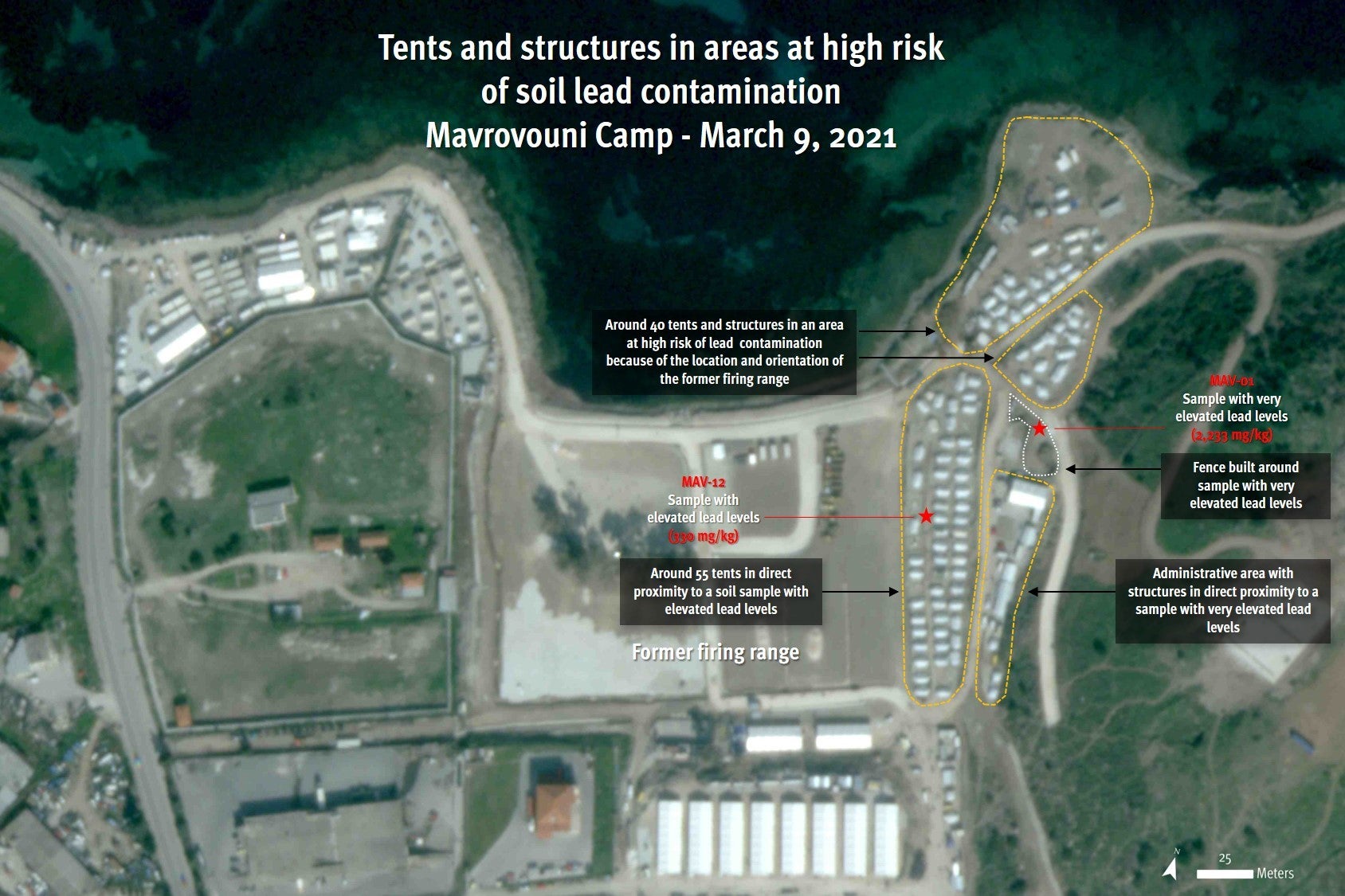
Satellite imagery recorded on March 9, 2021, shows at least 90 tents, five reception structures and an administrative area in direct proximity to the areas where elevated lead levels were detected by the Greek Institute of Geology and Mineral Exploration (EAGME) in November 2020. Lower resolution satellite imagery from the end of March indicates that little has changed from March 9, and tents remain in this location. Satellite image courtesy of Planet Labs Inc.
© 2021 Planet Labs Inc