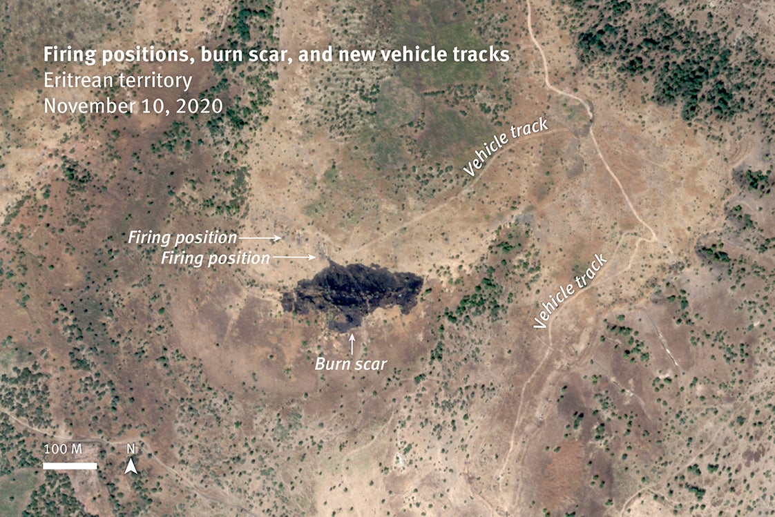
Analysis of satellite imagery shows new vehicle tracks leading to at least two firing positions established between November 6 and 9, 2020 that likely fired upon Humera on November 9 and 10. A burn scar is visible in front of one of these positions on satellite image recorded at 8:47 a.m. on November 10, that was not visible on satellite images collected the day before. The burned vegetation and resulting scar are created by unconsumed propellent ejected a short distance from a tank cannon.
© Analysis by Human Rights Watch; satellite image courtesy of Planet Labs Inc. 2021