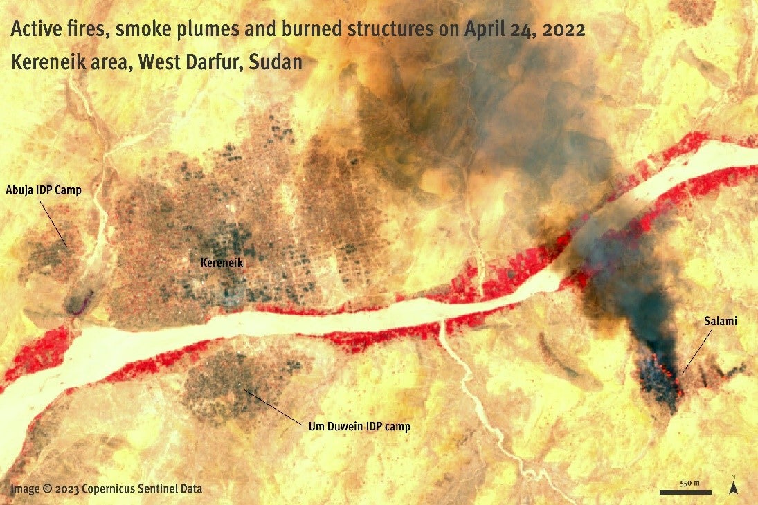
Infrared satellite image April 24, 2022, shows the extent of the burning in the town of Kereneik, West Darfur as well as ongoing smoke plumes in the village of Salami. On infrared images, the vegetation appears in red and the burned areas in darker colors. Image
© © 2023 Copernicus Sentinel Data.